West Virginia University in Vendée, France
WVU-V!
Sea, Salt and Wind
14 juin 2011
|
|
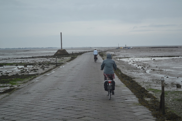
There is little sun this morning as we begin today's excursions. We travel to the northern part of the Vendee coast, a region that has been claimed from the sea starting with the Benedictine monks in the 7th century. Our first stop is in the Isle of Noirmoutier, which we are lucky to be able to access through the gois, a road that is covered by the high tide twice a day. It is the first time in several years that the Vendéens happen to be at the right time to cross the "road at the bottom of the ocean." |
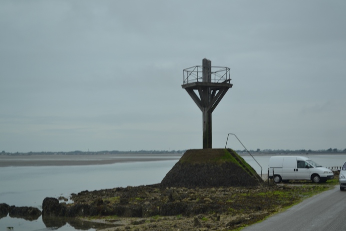
| This balise-refuge might become very handy in a couple of weeks when the Tour de France travels this road. Should stragglers not be safe on land when the tide comes in (at the speed of a galloping horse they say), they can always abandon their bikes and climb on a pole, waiting for the coast-guards to pick them up. The last time the Tour de France took the gois, the tide was not as much of a problem as was the thin layer of stilt that covered the road. |
|
|
|
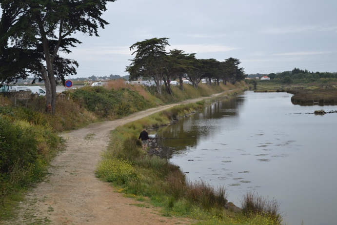
We are going to hear a lot today about the various means used by the monks to conquer dry, arable land. Here we stand on a dike that protects the island from north to south. |
| The parcels of land gained from the sea are called polders. Because of their impressive ecosystem, polders are protected by the government. |
|
|
|
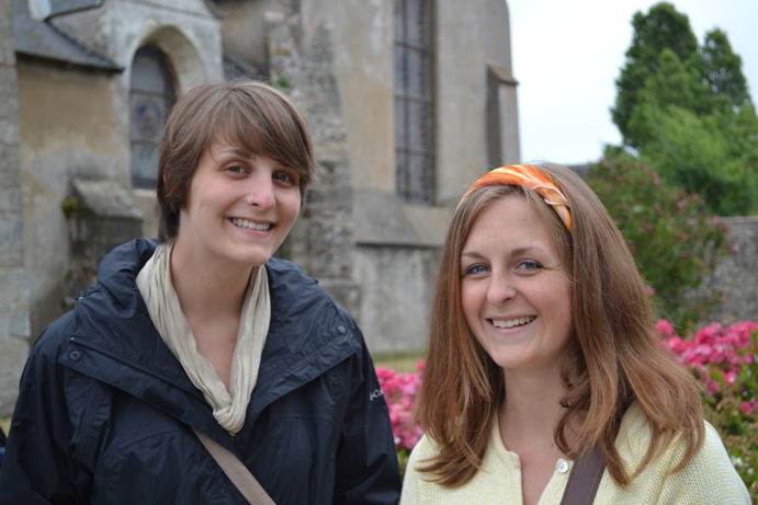
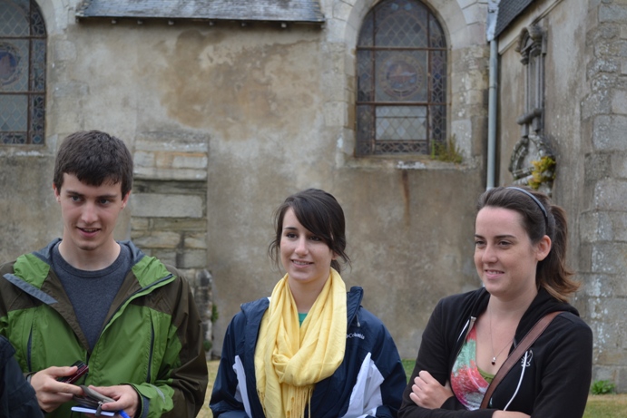
Who needs sunshine when we have Miranda's and Holly's smiles? |
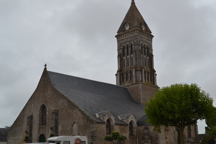
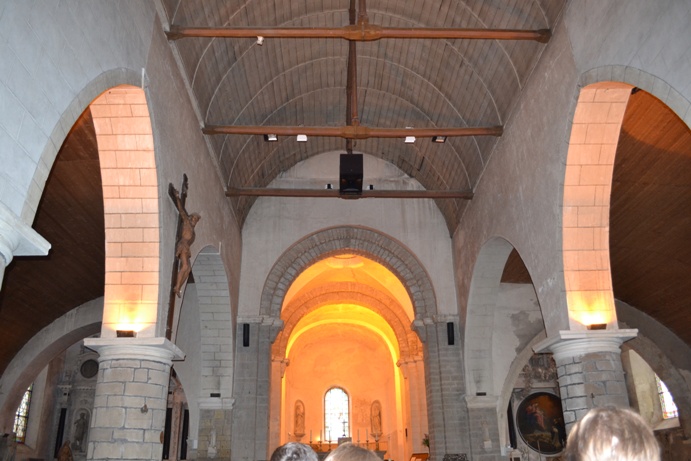
| We arrive on the Place du Château in the town of Noirmoutier-en-l'Île, and we meet Brigitte, and old friend of WVU-V. Our guide makes us chuckle as she speaks of this "new" church behind our group. She is almost apologetic as the current edifice was only built between the XIth and the XIIth centuries... The original buildings from the VIIIth and IXth centuries are gone! |
|

|
|
Actually, this church is dedicated to a much older friend of WVU-V than Brigitte--Saint Philbert, the VIIth century Benedictine monk who started both the religious and the economic development of the then impoverished island. |
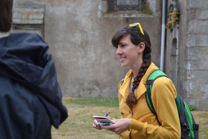
| Amanda is taking notes, but notice she has her camera in hand, should Saint Philbert's ghost decide to visit with us. |
|
|
|
Those three (of group Clemenceau) are also ready to take on Old Saint Phil'... |
| Note that the church was the work of men who built more boats than they did churches, hence the upside down hull shape of this beautiful ceiling. |
|
|
|
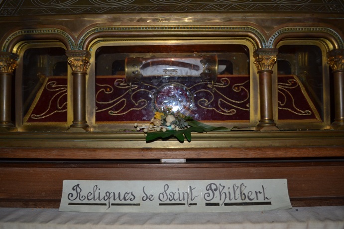
Well, well, what do you know? Saint Philbert is sitting in the crypt, waiting for us with a sheaf of wheat, symbolizing his crucial role in the development of agriculture in Noirmoutier. |
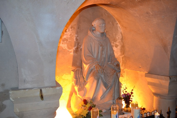
| Should you happen to have excellent vision, you will be able to identify one of Saint Philbert's ribs as well as one of his vertebrae. These relics were--and still are--exposed for pilgrims who come and pray to the venerable figure of Saint Philbert. |
|
|
|
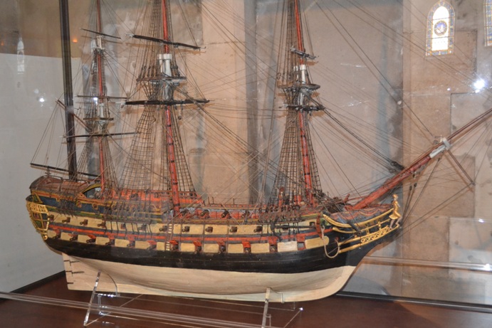
This boat was built as an ex-voto (literally, after the wish) by sailors who had promised to acknowledge their thanks to the Virgin, should they be safe from a storm. This ex-voto used to hang from the ceiling of the church, but for safety reasons, it is now in a glass case on a table. |
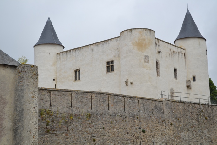
| Long after the monks left the island, the prosperity they had brought to the region continued: wheat, but especially salt, made Noirmoutier a prize sought out by many powers, local and foreign. This castle, once surrounded by the sea, was erected in the XIIth century and is one of the few still standing tall and strong. |
|
|
|
We are now on the Plage des Dames, a site that represents the main economic activity of the island today--tourism. Much as it happened in Les Sables, the new fashion of sea-bathing in the XIXth century attracted rich city-dwellers from Nantes, Saint-Nazaire, La Roche-sur-Yon, and even Paris. In the little cabins on the side, ladies could change into their swimming-dresses and venture out in the sea. |
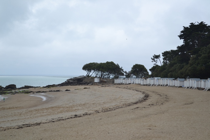
| One of the very attractive features of this island for nineteenth-century baigneurs, or tourists as they are called today, was the unusual vegetation of Noirmoutier. Because of the warm climate, much of its flowers and trees on the island are similar to those found on the Mediterranean coast. Here, we stand under a canopy of live-oaks, the state tree of Georgia! |
|
|
|
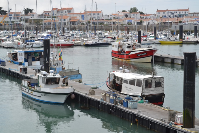
Much as it is in Les Sables, the port of the Herbaudičre is now dominated by pleasure boats, with only about 50 fishing boats remaining. |
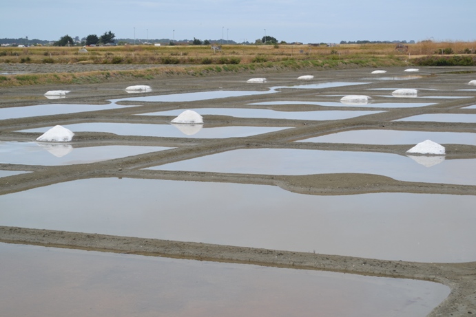
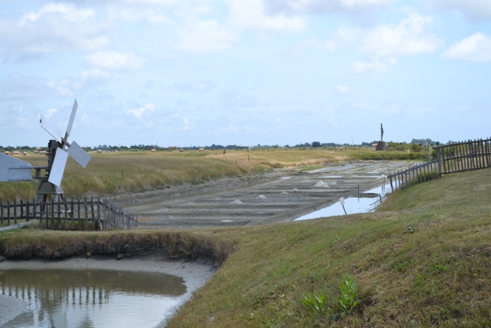
| Before we close the tour of the island, we stop at a salt marsh. The monks taught the islanders to cultivate the salt following a technique used by the Romans--an elaborate maze of channels and pools in which the sea water evaporates, thanks to the wind and sun, until the concentration of salt is so great that it crystallizes. Because the weather in these parts of France has been so, so dry and warm during the months of April and May, the salt is already gathered in the white mounds (much earlier in the season than usual). |
|
|
|
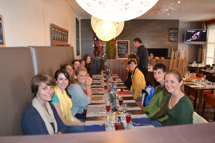
Now, time for a break! We start with a kir royal, a popular drink of champagne with currant liquor. You might think that our Vendéens are smiling because of the kir royal, but not at all: our server has also brought small plates of crevettes grises, small gray shrimp eaten with the shell on! |
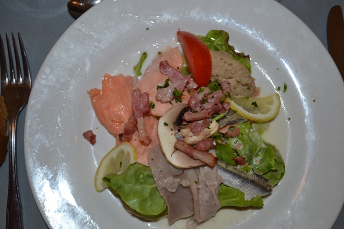
| First course: salade de terre et mer. Land and Sea salad: salmon, tuna, anchovies, bacon and lettuce. |
|
|
|
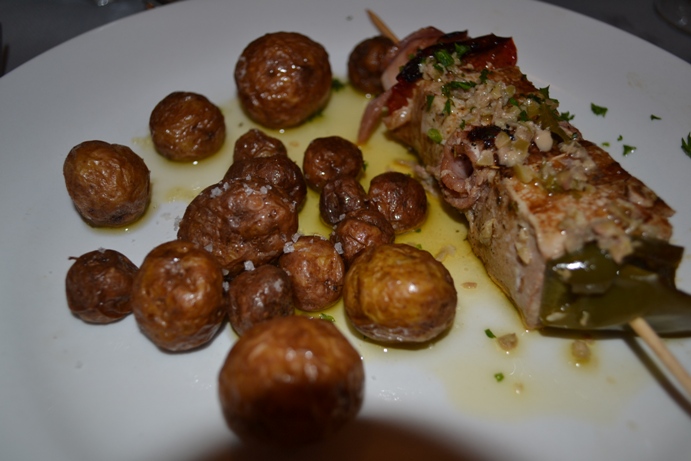
Our main course is a kebab of tuna and Vendée ham, with the mandatory Noirmoutier potatoes. Now, if you have never tasted one of those puppies, you do not know what a potato is... Notice the fleur de sel, the high-priced salt sprinkled on the locally-grown potatoes. |
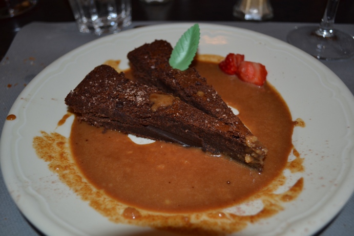
| Are you ready for your moëlleux au chocolat with caramel au beurre salé? Or, in simpler terms, brownies with butterscotch sauce? Delicious! |
|
|
|
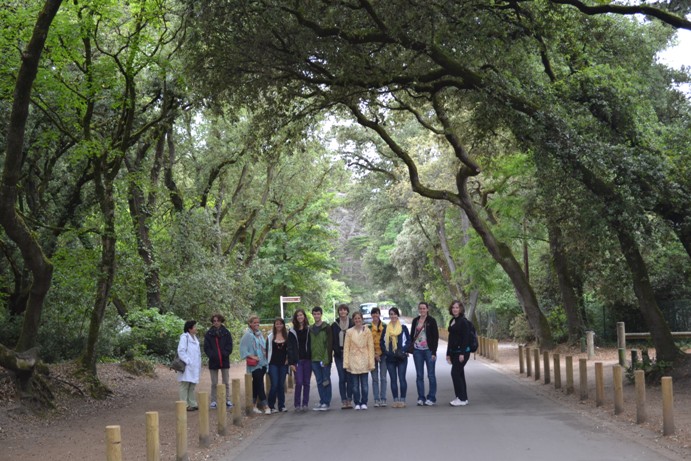
We meet our guide, Marion, who deems it necessary to explain that she is actually not a Vendéenne nor a Bretonne. No kidding! Her Southern accent is so strong it is charming. |
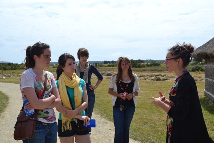
| We are here to visit the Écomusée du Daviaud, a museum dedicated to the preservation of the traditional way of life in the marshes, rather than works of art. |
|
|
|
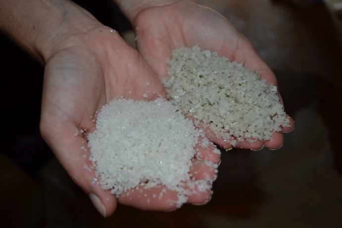
As on the island of Noirmoutier, the collection of salt was literally a gold mine. For many centuries this region of France supplied salt for the preservation of meats to much of Europe. |
| Marion explains the difference between regular salt in her left hand, colored gray by the clay that forms in the bottom of the basins. In her right hand is the light, white, expensive fleur de sel that floats on top of the water. |
|
|
|
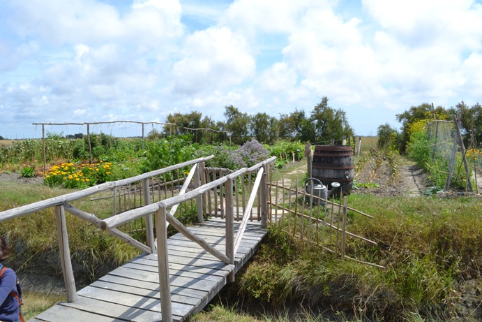
"Rich" farms in the marshes included a vegetable garden. |
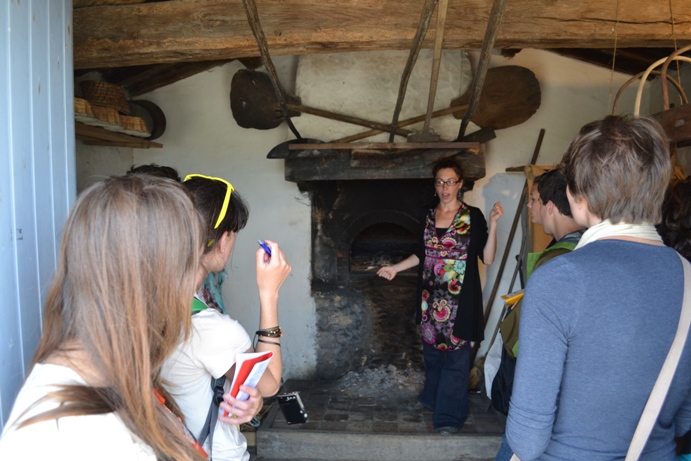
| Marion explains how we can identify this house as a rich farm. Stone was used to build not only the walls but also the bread oven. Bread was baked only once a week, as it took one full day for the oven to reach the desired temperature. |
|
|
|
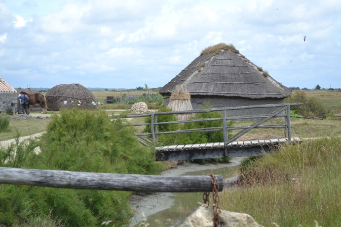
The lovely buildings are not ... whatever you thought they were. They are duck-egg-laying huts. Who would have thought? And trust us, the French expression is lovelier: pondoires... |
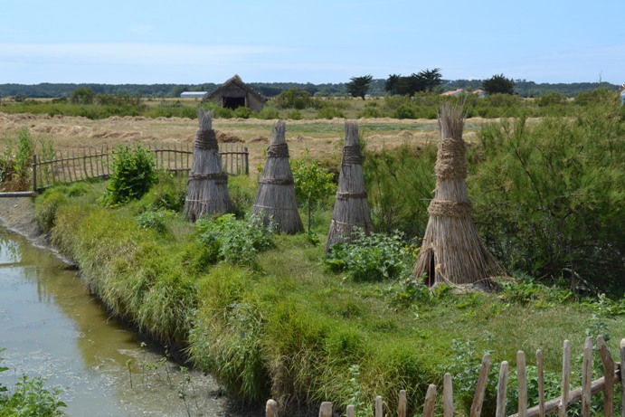
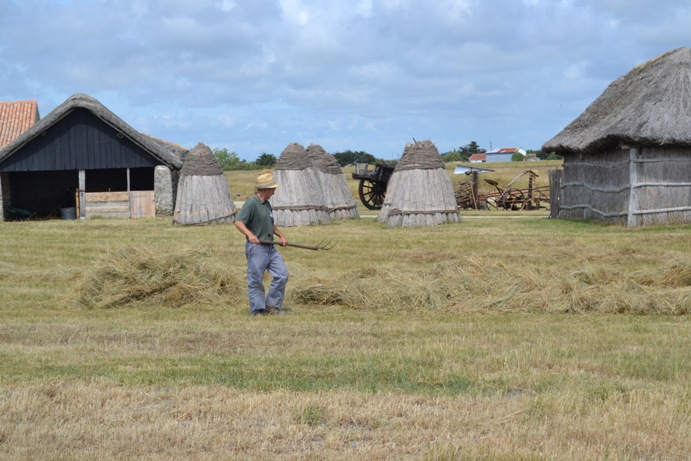
| Ancient farming techniques and tools are preserved. Notice the stacks of reeds drying in the background. More on these in a minute. |
|
|
|
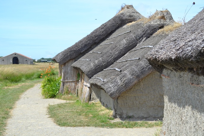
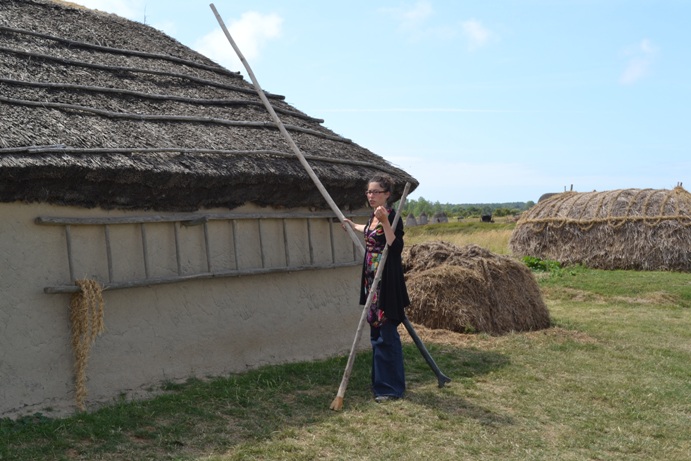
The construction of these houses is very similar to those that we saw last week at the CAIRN from the Neolithic period: the walls are of a mixture of clay, sand and straw, the roofs are made of dried reeds packed tightly and hammered into place. Notice the small deposit of clay on top to hold the reeds in place. Various opportunistic plants then grow on top of the houses. |
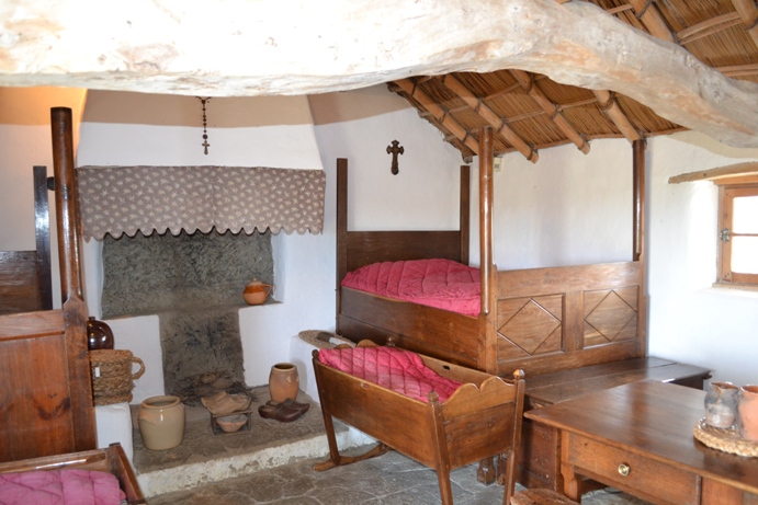
| Inside the house, also called a bourrine, (because of the method used to hammer the reeds), the furniture stands on high legs, as it is always possible for the sea water to rush in the marshes, which lay below sea level when all is well. |
|
|
|
Still freshly arrived from the south, Marion has not yet been trained in the art of channel jumping, a common mode of transportation in the old days. Plant your ningle in the middle of a channel full of water, grab it and swing swiftly to the other side. Dr. Orlikoff, well-versed in the art of the ningle, refuses to give Marion a lesson. |
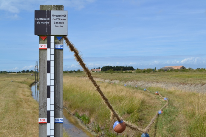
| Our last stop of the days is to admire a
sculpture done by an artist in residence at the Écomusée. Notice
the red marks: they show the strength (or coefficient) of the tide,
while the blue marks indicate the height of the sea at this particular
strength. Therefore, at this point, without the dikes, we would be under
water. Merci Saint Philbert! Note that the weather at the end of this full day is much brighter than when we started! Again, merci St. Phil! |
|